The National Oceanic and Atmospheric Administration’s Climate Prediction Center says there is a 60% chance that a weak La Niña event will develop this fall and it could last until March.
La Niña is part of a natural climate cycle that can cause extreme weather conditions across the planet, and its effects vary from place to place.
Although there is no guarantee how La Niña will develop, there are some general trends. Experts say northern parts of South America could see more rain than usual. The southern regions of the United States and parts of Mexico could be drier than average. The northern United States and southern Canada could be wetter than average.
La Niña is the cold phase of the El Niño-Southern Oscillation, a naturally occurring global weather pattern that involves changes in wind and ocean temperatures in the Pacific and can cause extreme weather across the planet.
El Niño is the warm phase and occurs when the trade winds that normally blow across the Pacific toward Asia weaken, allowing warm ocean waters to build up along the western edge of South America. But during La Niña, trade winds intensify and cold deep sea water rises, resulting in colder than average ocean temperatures in the eastern Pacific.
These cold ocean temperatures and changes in the atmosphere affect the position of the jet stream (a narrow band of fast-moving air that flows from west to east around the planet) by pushing it northward. The jet stream sits over the ocean and can take advantage of its moisture, influencing the paths taken by storms and increasing precipitation.
Recently, Earth experienced a “triple dip” La Niña event from 2020 to 2023. “We had three consecutive winters where we had La Niña conditions, which was unusual because the only other instance of that occurred between 1973 and 1976. “said Michelle L’Heurex, NOAA climate scientist. L’Heurex said La Niña events tend to last longer and be more recurring than El Niño events.
“It’s unusual, although it’s unprecedented,” Ben Cook, a climate scientist at NASA’s Goddard Institute for Space Studies affiliated with Columbia University, said of the forecast for a possible La Niña this year.
Cook noted that the frequency of La Niña events can be stressful for regions that have been dealing with droughts lately, such as East Africa. “If we’re heading into another La Niña event, it means kind of a continuation of those really bad conditions.”
Climate impacts of La Niña
The influence La Niña has on the climate varies by location and season, L’Heurex said. Parts of South America, such as eastern Argentina, may be drier than average, while Colombia, Venezuela and northern Brazil may be wetter than normal.
“It depends exactly where you are. Part of this is because there is a monsoon cycle, wet and dry season, that runs through Central America and South America, so La Niña is basically changing the intensity and location of those monsoon cycles,” L’Heurex explained.
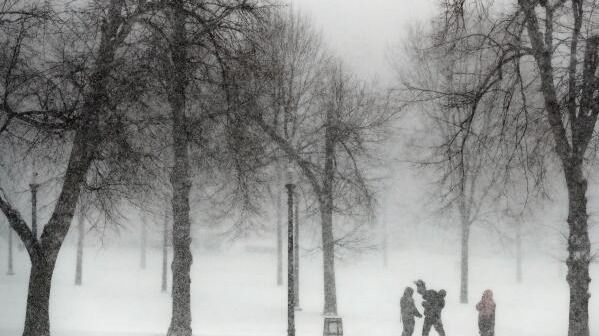
In the United States, the Northeast and Ohio Valley typically have wetter-than-normal conditions with an active storm track due to the position of the jet stream, said Samantha Borisoff, a climate scientist with NOAA’s Northeast Regional Climate Center. based at Cornell University.
The undulation of the jet stream can also cause more frequent cold outbreaks, particularly in the central and southern U.S. Borisoff said snowfall is difficult to predict and depends largely on the storm and the path it takes, But he noted that New England, New York, and the Great Lakes Region tend to have more snow during La Niña winters, but that’s never a guarantee. The southern and southeastern regions of the US are further from the path of active storms and tend to be drier and warmer than normal.
La Nina, El Nino and climate change
Scientists say the link between climate change and La Niña and El Niño is not entirely clear.
Paul Roundy, a climate scientist at the University at Albany, said climate models tend to indicate more frequent El Niño and less frequent La Niña, but not all models agree. Computer models also struggle to separate normal variation in El Niño and La Niña phases from the warming influence of climate change on the oceans and atmosphere.
“I wouldn’t infer from that that climate change isn’t actually causing more El Niño events,” Roundy said. “What happens is that nature itself has such strong oscillations. “So we can have multiple La Niña events, and maybe in 40 or 50 years we will see the opposite.”
Disclaimer:
The information contained in this post is for general information purposes only. We make no representations or warranties of any kind, express or implied, about the completeness, accuracy, reliability, suitability or availability with respect to the website or the information, products, services, or related graphics contained on the post for any purpose.
We respect the intellectual property rights of content creators. If you are the owner of any material featured on our website and have concerns about its use, please contact us. We are committed to addressing any copyright issues promptly and will remove any material within 2 days of receiving a request from the rightful owner.